By Adam Landry
Photos by Chris Roussakis and Luther Caverly
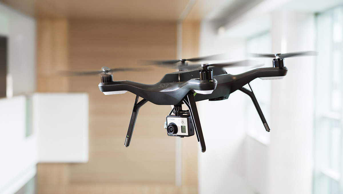
Uninhabited Aerial Vehicles (UAVs), also known as remotely piloted aircraft systems, have lifted off into the mainstream over the past decade. The term “drone” has navigated its way into our everyday vocabulary and ignited our imaginations to soar.
Naturally, our ability to find innovative applications for these new technologies has also risen to new heights.
Shifting from fringe technology to core asset, UAVs offer an extremely versatile and affordable platform that can be tailored to meet a wide range of industry needs. Besides being economically viable, they have proven invaluable in replacing humans who would otherwise be putting themselves at risk. UAVs have also emerged as an essential tool for research thanks to the advanced sensor technology available on today’s market.
“Aerial photography used to be out of reach in many industries,” notes Jeremy Laliberté, director of Carleton Aerospace. “Photos could only be taken from the ground, but now flybys have become quite commonplace in a wide array of fields where manned operations simply were not feasible.”
Laliberté, an associate professor in the Department of Mechanical and Aerospace Engineering, has been involved in Carleton’s UAV projects since the late 1990s, first as an external adviser from the National Research Council and then as a faculty member since 2008. His research focuses on novel aircraft structures, composite materials and hybrids, and next-generation air vehicle concepts.
One question he is routinely asked when discussing remotely piloted aircraft is what separates an off-the-shelf quadcopter from an industrial UAV. The answer, it seems, is a matter of application.
“One of the principles we teach in aircraft design is to focus on the application and build the aircraft platform around that mission,” he explains. “If you try to build an aircraft first and then fit a mission into it, it never quite works out and you’ll end up with something that doesn’t fulfill your initial goal.”
Practical applications of UAVs extend far beyond photography. Sectors such as agriculture have benefited from farmers being able to deploy drones to inspect and monitor their crops.
“It’s very expensive for a farmer to hire an airplane or a manned helicopter,” notes Laliberté. “But if you can come in with a UAV and do it for a fraction of the cost, now the farmer is interested and can benefit by determining what works best to increase their yields or how much they can limit the use of fertilizers.”
Upon hearing the term drone, most are quick to picture the type of multi-rotor helicopter used for tasks such as military reconnaissance. While drones certainly can fit this application, they come in a variety of forms and sizes to suit diverse purposes, such as surveying buildings or inspecting areas that would be difficult or impossible for a human to reach.
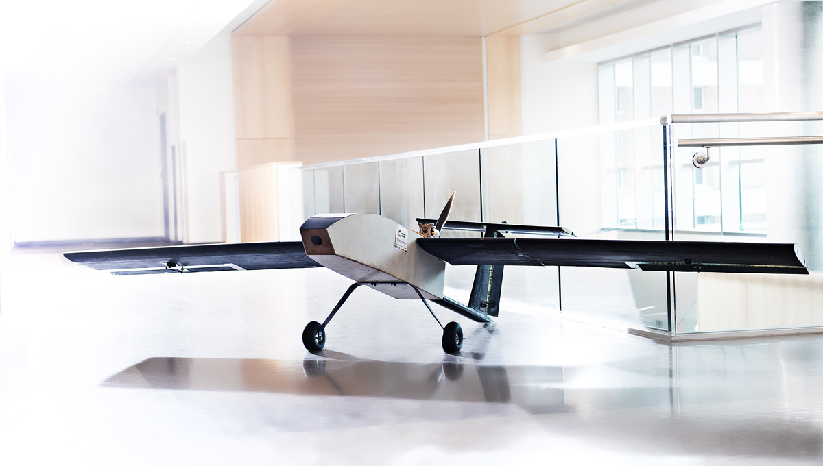
Another category of UAVs include fixed-winged aircraft that resemble passenger and commercial airplanes. They have greater endurance and are able to fly for many hours, making them ideal for geophysics and Arctic surveillance. However, these benefits come hand-in-hand with greater challenges in obtaining permits and certification.
One of Carleton’s most complex UAVs, GeoSurv II, was developed by undergraduate engineering students in partnership with Sander Geophysics Ltd. to supplement a manned aircraft as part of their fourth-year project. First launched in 2004, GeoSurv II follows a fixed-wing approach and is one of the largest UAVs of its kind in Canada built by an undergraduate team.
In 2009, Carleton undergraduate and graduate students began development of Corvus, a smaller and more versatile fixed-wing UAV. First flown in 2013, Corvus has been utilized as a modular multi-mission aircraft and is now part of a project funded by the Natural Sciences and Engineering Research Council to conduct airborne geophysics.
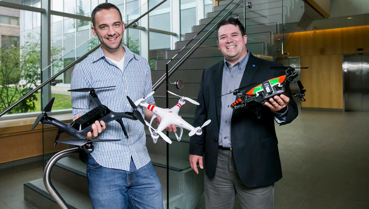
Darren Penley, left, and Prof. Jeremy Laliberté are utilizing drone technology to enhance their research at Carleton
With over a dozen faculty members at Carleton currently designing, building or working with UAVs for research purposes, it comes as no surprise that Laliberté has embraced the use of remotely piloted aircraft. As part of a recently awarded NSERC CREATE grant in Heritage Engineering led by Prof. Mario Santana, he will be using a special UAV-mounted technology known as a Lidar laser scanner in order to produce accurate, high-resolution models of objects and buildings.
“When we look at buildings that were constructed 200 years ago, we don’t have access to modern schematics and information,” Laliberté explains. “This technology will help us preserve these heritage sites for the future.”
The benefits that have arisen from the upswing of UAV technologies are also accompanied by an increased need for regulation. As their application continues to expand, the broader implications and future of these remotely piloted aircraft continue to be evaluated.
At present, commercial UAV use is not permitted in the United States. The Federal Aviation Administration does grant exemptions in specific areas, such as cinematography for film production and for real estate, but it may be some time before commercial operations on a large scale become a reality. In Canada; however, our regulatory environment allows for commercial drone use, providing businesses here at home with the opportunity to explore the advantages of UAV ventures.
Unsurprisingly, package delivery giants are among the first to invest in UAV research and development, hoping to one day be able to offer delivery inside a matter of hours. The infrastructure to facilitate such complex and large scale operations does not currently exist in Canada, but Laliberté feels it is only a matter of time before we see that level of sophistication.
“If you require a network of hundreds or thousands of small drones delivering packages, you can’t possibly have one person per vehicle keeping an eye on things,” he explains. “It would have to rely on an enhanced air traffic control system.”
Thankfully, Canada, the United States and several European nations have been working on such an initiative over the past decade. Their aim is to produce the next generation of the air traffic control system. The need arises from the inability of current systems, based on large radars, to detect small UAVs and drones. New methods will instead utilize GPS technology in tandem with transponders on the aircraft, allowing UAVs and crewed aircraft to automatically talk to one another and communicate their locations, routes, speeds and altitudes. In the immediate future, personnel will still be required on the ground to monitor drone activity.
Keeping everything in the air is not the only concern of Canadians. The privacy commissioners of Canada and Ontario have both written substantial reports on UAVs and their implications for privacy. While these reports determined that our existing laws regarding privacy are sufficient for the time being, such as those limiting police surveillance and those regarding photo consent, each report warned of an erosion of public expectations towards privacy if drones become ubiquitous in our society.
Laliberté is of the opinion that, while we should be concerned, it should be in the bigger context of surveillance, photography and privacy. However, he is quick to comment that “while a great deal of information already resides in the public domain, such as aerial views of urban areas on Google Maps, no other tool matches a UAV’s ability to capture detailed real-time information.”
In response to concerns relating to privacy and safety, some cities and counties in the U.S. have banned the use of UAVs altogether. In Canada, municipalities do not have the power to impose such limitations on drone use, with Transport Canada acting as the federal regulatory authority for all remotely piloted aircraft.
While Canada’s restrictions and penalties on the use of UAVs are well-established, authorities have not been able to fully prevent their use in unsafe areas, such as near airports or in densely populated urban areas. Laliberté believes education is the key to easing the integration of UAVs into public life.
“It is without question that, as drone use becomes more commonplace among the public, we will need to adapt our laws to address concerns that may arise,” he says. “Currently, non-recreational drone use does require permits, a fact to which many are unaware.”
When asked what improvements he would like to see in the near future, Laliberté alluded to an increase in automated intelligence, such as the ability for a UAV to adapt to the context of its surroundings.
“If a drone needed to land suddenly, hopefully they will soon be able to identify obstacles and determine a safe path of descent, avoiding power lines, trees and pedestrians automatically.”
Tuesday, May 24, 2016 in Aerospace, Engineering, Research
Share: Twitter, Facebook